.png)
Construction Progress Monitoring
Recurring drone flights that document your site from groundbreaking to closeout.
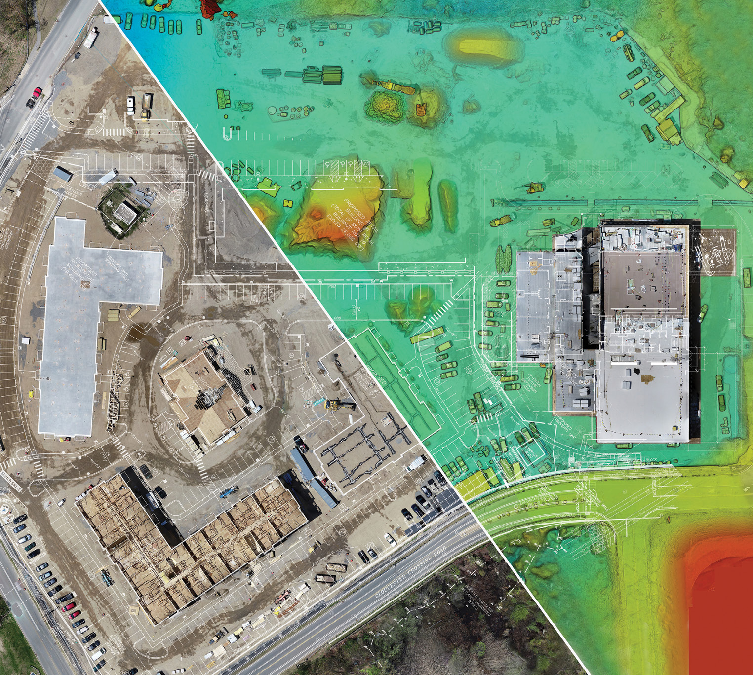
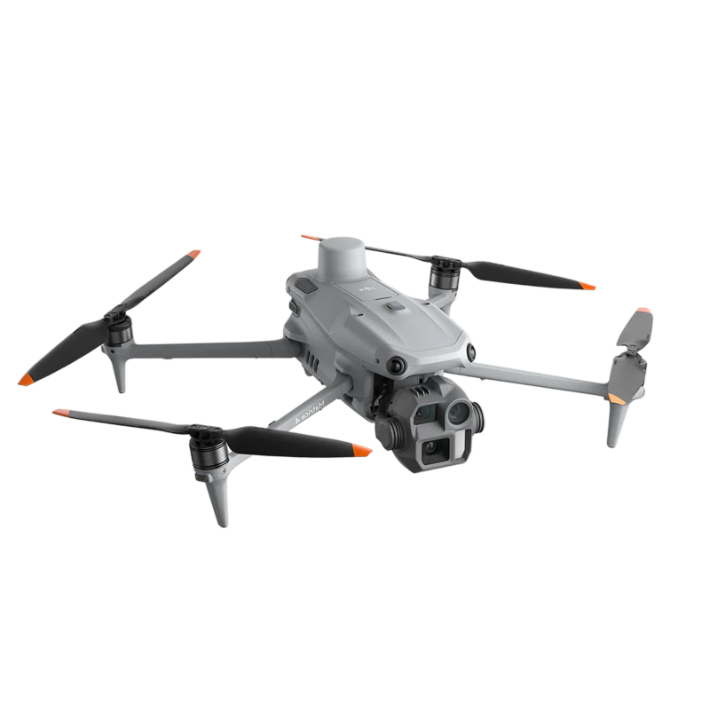
Same Vantage Point, Every Flight
We fly your site on a set schedule, so every visit matches the last.
Weekly or monthly flights
Same flight path every visit
A visual record from groundbreaking through closeout
Shareable with the whole project team

Survey-Grade Data For Civil Teams
We capture accurate topography and site conditions from the air and deliver them in formats your surveyor or engineer of record can build on.
Topographic surveys, contours, and surface models
Cut/fill and earthwork volumes
Drainage and grading analysis
As-built documentation
CAD-ready and GIS-ready deliverables
We provide aerial data capture and mapping. Licensed surveying is performed by a registered professional where required.
From Groundbreaking To Closeout
One site, six flights: from empty plot to closeout.
%201.jpg)
Baseline Flight
The empty plot is mapped and outlined before work starts.
Orthomosaic of existing conditions
Boundary and layout outlined
%201.jpg)
Clearing And Earthwork
Site cleared and graded, with pad and parking areas measured.
Graded areas measured from above
Earthwork tracked flight to flight
%201.jpg)
Building Pad Ready
Graded pad with the building foundation outlined on the map.
Pad checked against the site plan
Foundation outline on the map
%201.jpg)
Structure Takes Shape
Building footprint and parking curbs tracked against the plan.
Footprint compared to the plan
Curbs and parking tracked
%201.jpg)
Paving Underway
Building enclosed while parking and drives are paved.
Paving progress documented
Enclosure milestone recorded
%201.jpg)
Closeout Record
Finished site, ponds and parking mapped for the final record.
Final as-built site map
Permanent record for the owner
What You Get From Every Flight
Choose the outputs your team needs. One flight can produce several.
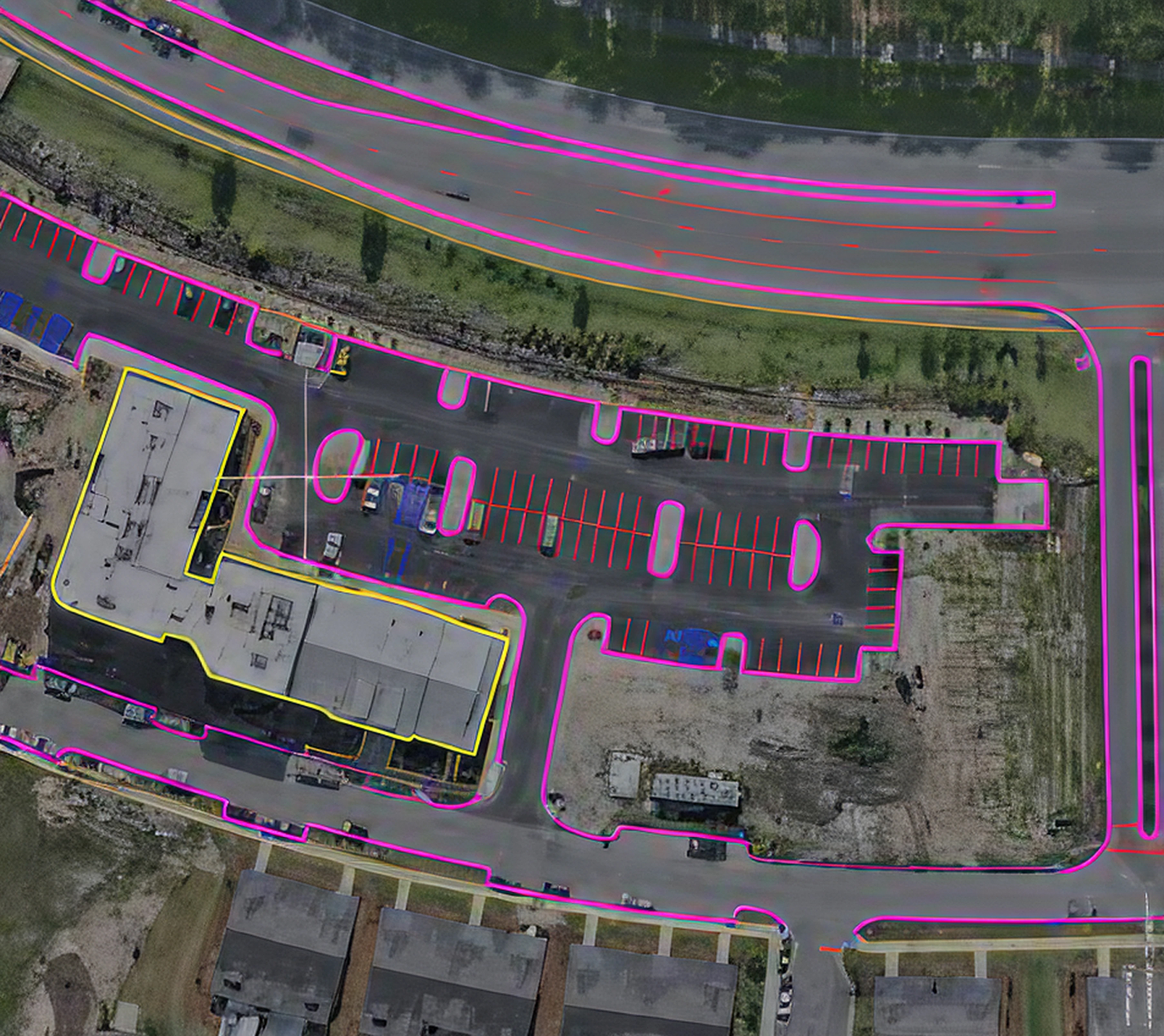
To-Scale Maps Of Your Site
Detailed, to-scale aerial site map
Measure distances and areas on screen
Check the layout against plans and drawings
Easy to share with owners and subs
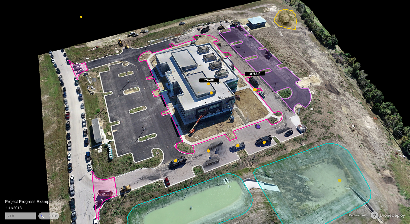
3D Models And Digital Twins
Photogrammetry-based 3D model of your site
View structures and terrain from any angle
Digital twin for planning and coordination
Built from your mapping flights
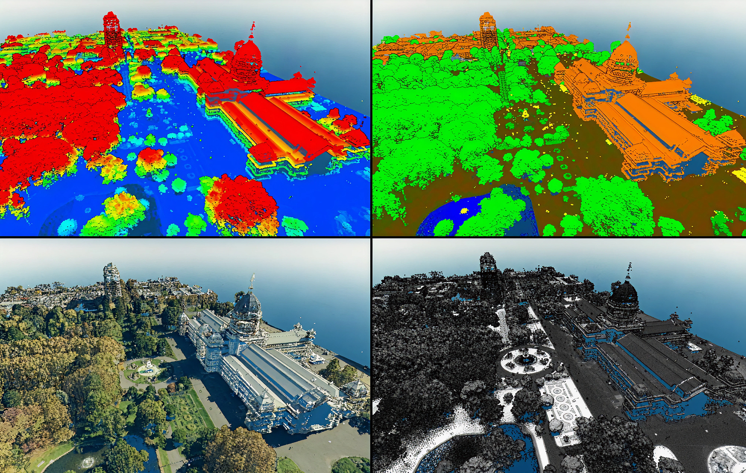
Existing-Conditions Data From LiDAR
Dense point clouds with centimeter-level detail
Accurate ground surfaces, even under vegetation
Ready for CAD, BIM and digital twins
Supports your surveyors and engineers
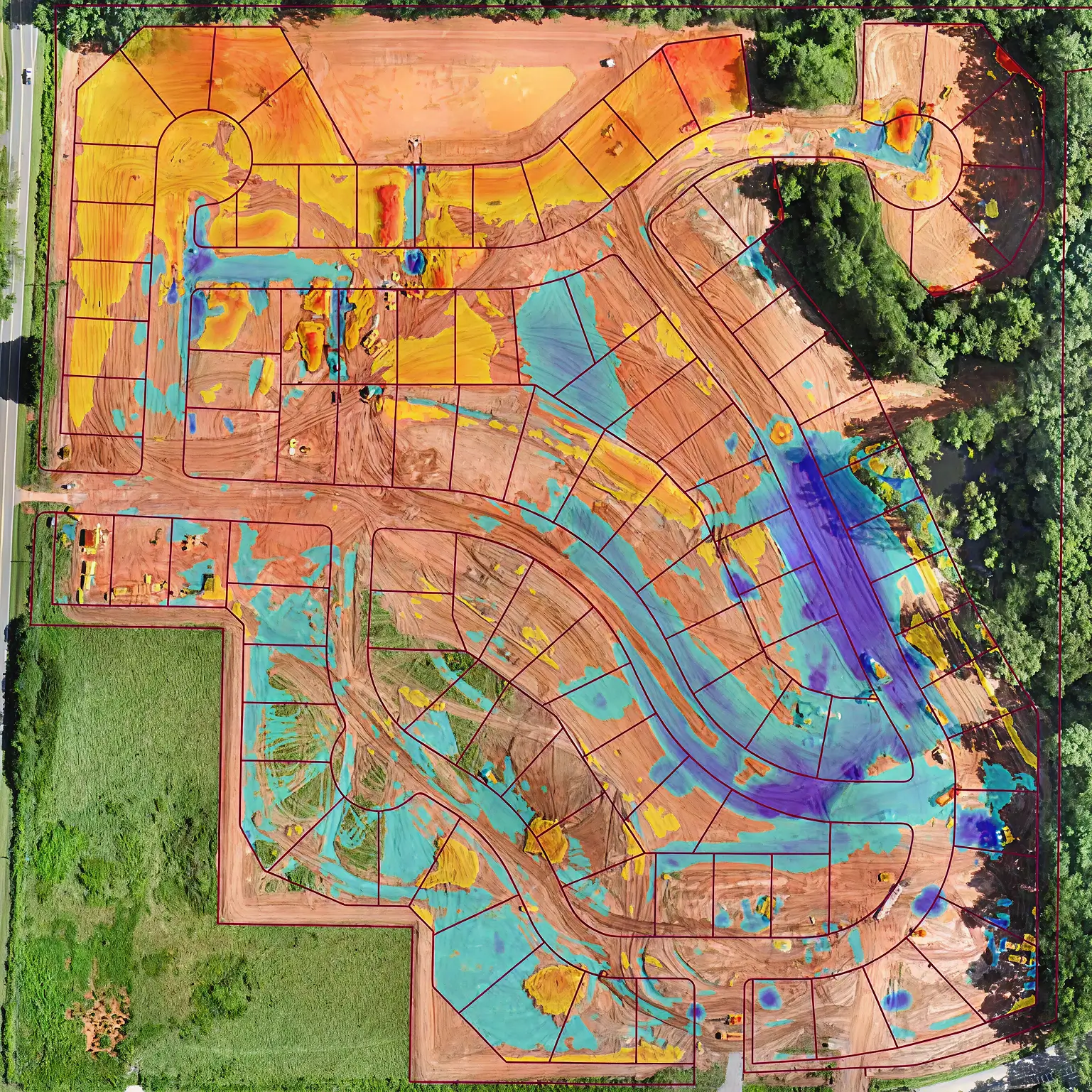
Volumetrics And Grading
Stockpile volume calculations
Earthwork quantities tracked flight to flight
Cut and fill analysis
Grading checks against the design surface
.jpg)
Progress Reports And Site-Over-Time Comparisons
Milestone snapshots from every flight
Side-by-side, site-over-time comparisons
Visual proof of completed work
A record you can share with stakeholders
Keep Every Project On Track
Everyone works from the same up-to-date view of the site.
Verify completed work against the plan
Coordinate subcontractors with a shared view
Catch issues early, before they get expensive
Keep remote stakeholders informed
Keep a historical record of the build
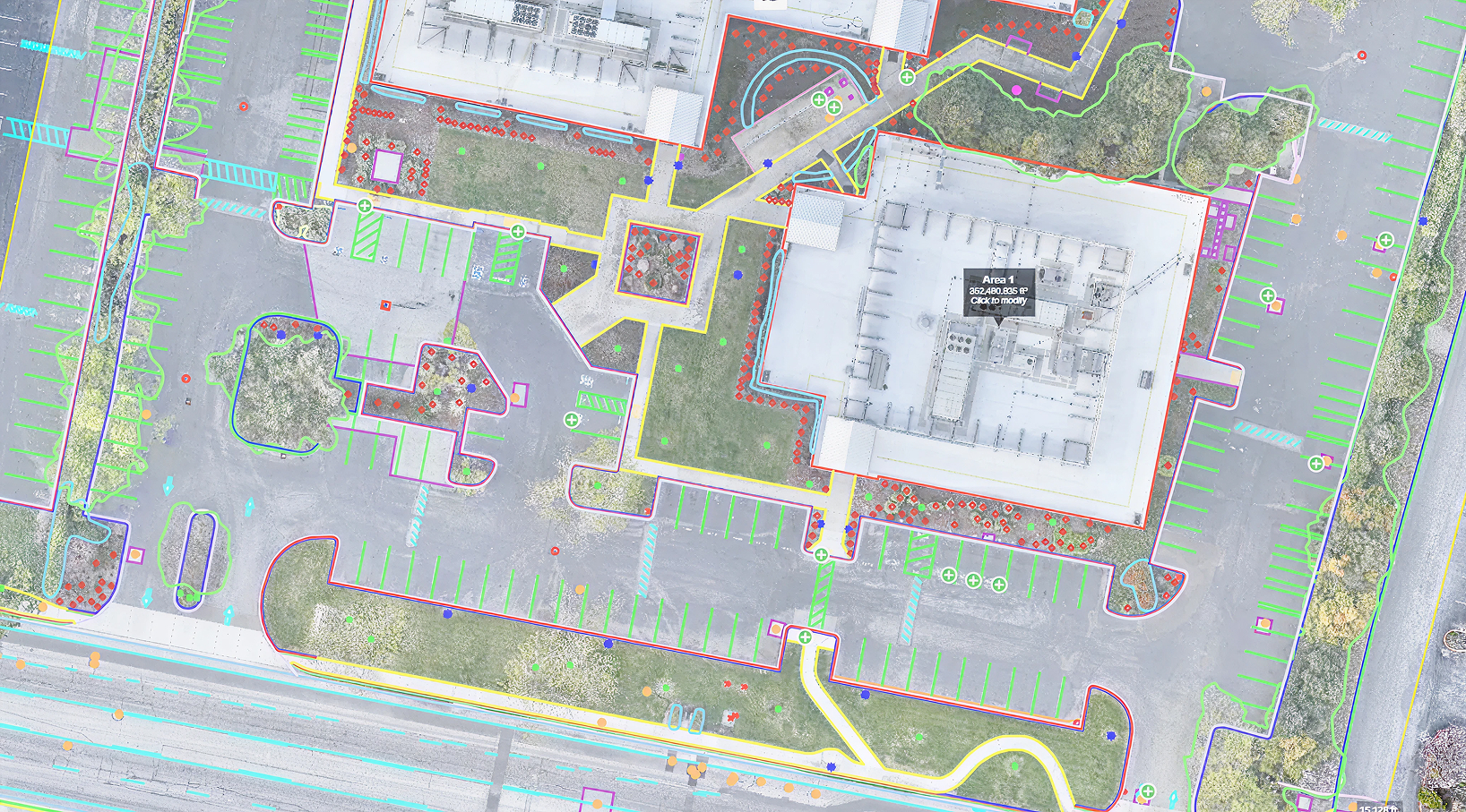
Built For The Whole Project Team
One shared view of the site, wherever your team is.
Start Documenting Your Site
Tell us about your project and we'll plan a flight schedule that fits.